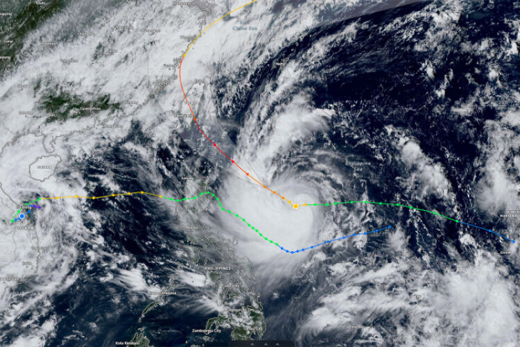
MANILA - Tropical Cyclone Kong-Rey has intensified into a typhoon and is threatening to bring strong winds and torrential rain to the northern Philippines, before tracking toward Taiwan and making landfall.
Kong-Rey — known locally in the Philippines as Leon — has maximum sustained winds of 130 kilometres (81 miles) per hour, according to the latest advisory from the nation’s weather bureau Tuesday. That makes the storm equivalent to a Category 1 hurricane on the five-step Saffir-Simpson scale.
The typhoon will lash parts of Luzon — the main island of the Philippines — just days after Tropical Storm Trami made landfall, leading to widespread flooding and killing over 100 people. The province of Batanes and parts of rice-producing Cagayan could get intense to torrential rainfall of as much as 200 millimetres (8 inches) in coming days.
Kong-Rey’s strong to typhoon-force winds extend outwards up to 640km from the centre, and the system is 555km east of Tuguegarao City. The storm is expected to intensify over the next 48 hours.
On its current track, Kong-Rey could cross the southeastern coast of Taiwan on Thursday, and then move over the island before threatening to make landfall in southern China later in the week.


