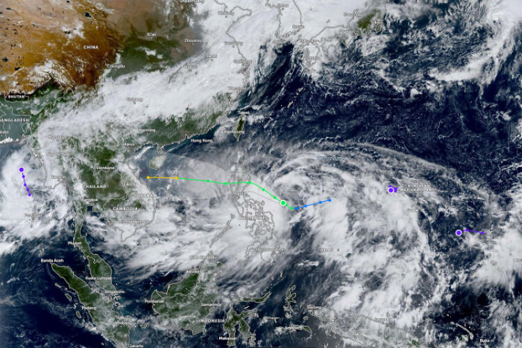
MANILA - Tropical Storm Trami is moving toward the main island of the Philippines and is expected to strengthen before making landfall, bringing heavy rain and threatening rice crops.
Trami — known locally as Kristine — has top sustained winds of 65 kilometres (40 miles) per hour and strong gale-force winds that extend outward up to 680km, according to the Philippines’ weather agency.
The storm is forecast to cross the Luzon coast late Wednesday, or early Thursday morning.
Some areas have shut schools following a heavy rainfall warning issued for provinces south of the capital, Manila. The system is forecast to develop into a severe tropical storm before making landfall, the weather bureau said.
Trami is forecast to hit the Cagayan Valley, a major region of rice production that accounts for nearly one-sixth of the nation’s total output. The storm comes in the middle of the country’s second annual rice planting season, just weeks after Typhoon Yagi wiped out nearly 49,000 tonnes of rice crops, according to the United States Department of Agriculture.
The storm is expected to weaken after coming ashore as it interacts with the mountain ranges of northern Luzon, according to the US Navy's Joint Typhoon Warning Centre. High sea-surface temperatures and low-to-moderate vertical wind shear will help the system re-intensify once it tracks over the sea to the west of the Philippines, the centre said.
The Philippines’ weather agency expects Trami to strengthen into a typhoon once it emerges over the South China Sea. From there, it could track toward the central region of Vietnam, or edge closer to the coast of southern China, according to the Hong Kong Observatory.
The Philippines is one of the countries most exposed to more extreme weather events caused by climate change, with an average of 20 typhoons hitting the nation every year.
Super typhoon Trami is seen from the International Space Station as it moves in the direction of Japan in this image obtained from social media on Sept 26, 2018. (File photo: Reuters)


